
River walks and cycle rides in Britain
Last updated: 16 August 2026
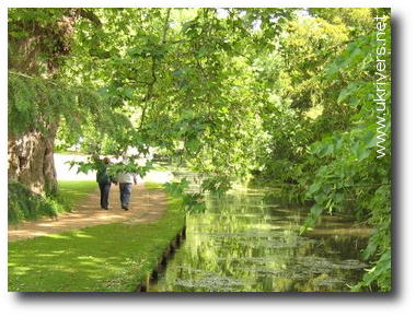
Photo: Walking along the River Test at Mottisfont, Hampshire.
Everyone knows that rivers and canals make great places for a walk or a cycle, but sometimes we need a bit of prompting to get away from the TV and explore. That's the thinking behind our handy new page of riverside walks and cycle rides! If you love wandering with the water, you'll find ideas for hundreds of walks and rides you can try.
If you prefer to walk with other people, you'll find that many of the groups featured on our network page organize regular river walks. You'll also find a number of forthcoming walks listed on our events page.
Sites that contain many different walks are marked with three asterisks, like this ***
Help us improve this page!
This page is a guide, not an encyclopedia, and it's very much a work in progress. We know there are hundreds more river walks and cycles we could add. If you'd like to suggest others, please post details on our Facebook page.
General information
Transport
- Traveline: Postcode-to-postcode public transport journey planner. Really useful for planning walks without a car.
Maps
- Open Street Map: Editable maps of the UK (and world).
- Ordnance Survey: Get Outside: Quite a lot of walk ideas here, along with tips in map-reading, family activity ideas, and more.
- National Cycle Network/Sustrans: Links to National Cycle Network maps and route information.
- Geograph: A sort of giant photo collage of the entire country based on OS maps. Handy for checking out photos of places you want to visit, as is Flickr.
Groups
- Ramblers: A British registered charity that promotes rambling, protects rights of way, campaigns for access to open country and defends the countryside.
- *** Saturday Walkers Club: A London and Southeast England based walking group and their excellent website of over 400 walks you can try.
- CTC (Cyclists Touring Club) As the UK's National Cyclists' Organisation, CTC has been protecting and promoting the rights of cyclists since 1878.
Walking websites
- *** Waterway Guides: A comprehensive website from the Canal and River Trust for people who want to base holidays around canals and navigable rivers. Includes lots of walking and cycling information
- *** British Walks: David Cotton's site about the 1000+ walks he's done all across Britain contains photographs and written descriptions of many river and coastal walks.
- *** Walking in Scotland: The walking section of the official Scottish Tourism website has a really handy "find a walk" section with dozens of walks you can try out all across the country.
- *** National Trust: Downloadable Walks: Lots of walks for every region of England. Each one has its own downloadable leaflet/map.
- *** Walking with the Taxi Driver: A great selection of walks all over the country, many featuring rivers, lakes, and wetlands.
Walking
Many of the "walks" described here are also suitable for cyclists. There are some longer routes listed below specifically for cyclists or more ambitious walkers.
North of England
Durham
- High Force, Low Force and the River Tees from Bowlees: Lou Johnson takes us along 12 km (7.5 miles) of the River Tees in County Durham.
- Durham and the River Wear: A 5–10 mile circular walk along the Wear south of Durham.
Teeside
- Teesdale Way: A long distance path (161km or 100 miles) following the River Tees from the open moors of Cumbria and Durham through to the industrial heartland of Teeside.
- Weardale Way: Another long distance route (~100km or ~68 miles) following the River Wear through Stanhope, Bishop Auckland, Durham, and Sunderland.
- River Tees and Stockton: A selection of short walks along the River Tees, some also suitable for runners and cyclists.
Tyneside
- River Tyne/Hadrian's Wall: The 84 mile National Trail along Hadrian's Walk includes the riverside route in Tyneside and some of the most beautiful scenery in northern England. You don't have to walk the whole thing in one go: the route breaks up into many smaller linear and circular walks.
- Newcastle Quayside Walk: A short 3.2km (2 mile) stroll along the Tyne, taking in the city's famous river bridges.
Yorkshire and Lancashire
- *** Yorkshire Walks: Frank Firth's site includes a number of lovely riverside walks. The site original has been offline for a while, but archived versions are still available on the Wayback Machine.
- York City Walls and the River Ouse: Mike Kemp explores the ancient city walls and the River Ouse on a city-centre walk of about 7km (4.5 miles).
- *** York Walks: A number of interesting walks in and around York, including several that explore rivers and waterways.
- *** Walks along the River Aire: A selection of walks curated by the Aire Rivers Trust and Friends of Bradford's Beck.
- Walking the Ribble Way!: Ribble Rivers Trust's Cody Beaghan takes us on a 72-mile journey along the Ribble Way, a captivating long-distance trail that traces the course of the River Ribble from its mouth near Preston all the way to its source in the stunning Yorkshire Dales.
South of England and London
Berkshire
- [PDF] Lambourn Valley Way: The complete route is 31km (19 miles) from Whitehorse Hill to Newbury, where you can also follow the Kennet and Avon canal and accessible parts of the River Kennet. This is the official route guide from West Berkshire Council.
- Newbury to Reading along the Kennet & Avon canal: Walk or cycle this lovely route from Marsh Benham, just outside Newbury, all the way to Reading.
- Staines to Windsor: 15km (9 miles) along the Thames.
Hampshire
- Fleet Pond: You can walk all around the pond (and catch some birdlife on the way). Fleet Pond is right next to Fleet train station so easily accessible by public transport.
- [PDF] Itchen Navigation: Delightful walks alongside the old canal running between Winchester and Southampton, easily accessible by public transport from Winchester, Shawford, and Eastleigh.
- River Itchen Watermeadows and St Cross: A superb walk from the center of Winchester out to the old Hospital of St Cross.
- River Itchen: A circular walk from Easton to Shawford via Winchester: A lovely 30km (18-mile) walk by the River Itchen and Itchen Navigation through Winchester.
- River Blackwater: A great book of circular walks around the Blackwater Valley (on the borders of Berkshire, Hampshire and Surrey).
- River Hamble and Fareham: Duration: 1 hr 15 mins - 1 hr 45 mins.
- River Test: Test Way: A lovely 70km (44 mile) route across Hampshire, broadly following the course of the River Test and helpfully broken into eight manageable chunks on this Hampshire County Council website.
- River Test: The Riverdance Walk: A short 5-6km (3.5 mile) section of the Test Way at Longparish, Andover.
- River Test: Mottisfont to Romsey: A slightly tricky walk due to obstacles of various kinds, but well worth the effort.
- South Downs Way: an amazing 160km (100 miles) of chalk download walk, cycle, and bridleway, taking in the rivers Itchen, Meon, Cuckmere, Ouse, Adur, and Arun and the Sussex coast.
Hertfordshire
- *** Walking in the Footsteps of an Edwardian: A book of nine walks around the Colne Valley area, based on Stephen Springall's Country Rambles Round Uxbridge, published in 1907.
- Chess Valley Walk: A downloadable guide to a 10-mile walk near Chorleywood from the River Chess Association.
Kent
- Kentish Stour: Leaflets covering various walks through the Stour country of Kent, including lakes and other green spaces.
- River Eden and the South Downs: 7.00km (4.5 miles) taking in Penshurst, the River Eden, Smarts Hill, and the River Medway.
London, Thames Valley, and Chilterns
Thames
- *** River Thames Guide: Walking and Cycling: Lots of different Thames walks covered in a series of well-illustrated and well-described guides by Jeannette Briggs.
- Thames Path: Describes walking various different sections of the Thames from its source all the way to the Thames Barrier in Woolwich.
- *** Chilterns Walks: The Chilterns Society organizes regular walks throughout the Chilterns area and publishes dozens of walk leaflets/maps for free on its website.
- Walking on the River Thames: Maps and ideas for walking the Thames Path National Trail.
- Thames Path: "Follow the greatest river in England for 184 miles (294 km) from its source in the Cotswolds almost to the sea."
- Thames Medway Canal: A photographic wander along the canal.
- *** The Londonist: Weekend Walks: The River Ravensbourne From Catford To The Thames: There are quite a few walks on The Londonist site, including The Thames at Woolwich, but they're not easily organized or accessible. A few of the others on the site are listed under "Other London waterways", below.
- Henley on Thames: Various different walks around Henley featuring the Thames.
- The Bernard Levin London Bridges Walk: A very simple and very fun way to explore London. Great for kids! You simply cross each bridge over the Thames that you come to until you reach the next one—and then you cross again. You can do as many or as few bridges as you like. Archived from The Sydney Morning Herald.
- Walking the Thames: Kerry Jackson of the New Zealand Herald shows how to explore London by following its river.
- *** Thames Explorer Trust: Explore the Thames with Thames Explorer Trust's self-guided walk booklets.
Other London waterways
- River Quaggy: The Thames may dominate London, but it's not the only London river worth exploring—by a long way. If you're south of the river, check out the Quaggy between Lewisham and Elmstead. Here's John Rogers' guide.
- River Lea: A walk through the Lee Valley from Luton to London. Here's an alternative account of the Lea Valley Walk from the Walk London website. There's a public-transport-friendly Lea Valley Walk in six sections from Waltham Abbey to East India Dock from Transport for London. Luton Borough Council publishes a handy 24-page guide to an [PDF] Upper Lea Valley Walk.
- Regents Canal: A short (1.6km/1 mile) trip along the canal from Limehouse Basin to Mile End.
- New River Walk: The Londonist walks the New River, a manmade river carrying water the River Lea in Hertfordshire to Islington. Other Londonist river walks include Counter's Creek, the River Lea, the River Wandle, and the River Westbourne.
- A walk from King's Cross to Kenwood House along the River Fleet: Des Garrahan of the Inner London Ramblers takes us on a five-mile walk from King's Cross following the hidden river Fleet to Kenwood House on Hampstead Heath.
Surrey
- Virginia Water 90-minute walk: A medium-length walk featuring the lake and park.
- *** Waterside Walks in Surrey by David Weller: OpenLibrary catalogue details for David Weller's book, which covers 20 circular routes between 2 and 6 miles and includes the Thames, the River Wey Navigation, Shepperton Lock, Hampton Court, the Basingstoke Canal, the River Mole and the Mole Valley, and quite a lot more. You can buy it from all the usual places.
- *** Walk this Wey: Three lovely walks on the River Wey towpath in Surrey: Guildford to Godalming (5 Miles), Guildford to Pyrford (9 Miles), and Pyrford to The Thames (6 Miles).
Sussex
- *** Sussex Ouse: A selection of three walks in Ouse country, including Swanborough Hill and Lewes, Rodmell, and Firle Beacon and Cuckmere Haven.
- Bodiam Castle and the River Rother: Several walks described here of about 18.5km (11.5 miles), taking in the Rother Valley Steam Railway, Bodiam Castle, and the River Rother.
East Anglia
Cambridgeshire
- Cambridge to Grantchester Meadows: Includes details of the famous walk from the centre of Cambridge to the lovely village of Grantchester along the banks of the River Cam. Roughly 7 km (4.5 miles).
- Cambridge Cam Valley Walk: A well-described walk along the Cam through Cambridge from the BBC Cambridgeshire website.
Essex
- River Stour: Dedham Vale: An 11km (7 mile) walk through Constable country from The Guardian.
- Ten top UK winter walks: Flatford, Suffolk: David Piper, National Trust area warden, presents another walk through Constable country, also from The Guardian.
- ***Dedham Vale Walking Guides: A selection of 10 free, downloadable walking leaflets covering the Dedham Vale National Landscape and the Stour Valley.
- Colchester Roman River Walk: BBC Essex presents a walk along the River Colne to Colchester's Roman walls.
Suffolk
- *** Suffolk & Essex Coast & Heaths National Landscape: Downloadable guides covering great walks along the Rivers Stour, Orwell, Deben, and Alde in Suffolk and glorious nearby areas such as Minsmere.
- [PDF] River Snape Explorer: Two short and very lovely walks around the River Alde at Snape.
Midlands and Cotswolds
Birmingham and West Midlands
- Worcester & Birmingham Canal: A relatively simple 46km (28 mile) long-distance walk from Diglis Basin Worcester to Gas Street Basin in the centre of Birmingham.
Derbyshire
- River Lathkill and Lathkill Dale: A lovely walk through the Peak District.
Staffordshire
- Staffordshire Way: A long distance route spanning 153km (95 miles). Water interest includes the lovely River Dove and River Churnet (a tributary of the Dove), the Caldon Canal and the Trent and Mersey Canal.
- [PDF] Burton Washlands Circular Walk: A short stroll through the Washlands (the meadows and floodplain behind Burton Library). Here's a slightly longer alternative [PDF] Washlands Walk.
Nottinghamshire
- Trent Valley Way: A walk through Derbyshire and Nottinghamshire running from Long Eaton to West Stockwith, through Nottingham and Newark.
- River Trent: Nottingham: From Attenborough Nature Reserve along the Beeston Canal, Nottingham. A 6.8km (8 mile) walk along the River Trent that should take about 2 hours or so.
Oxfordshire
- The Thames Path: The 185 mile (298 km) trail takes in Oxford and the Cotswolds and takes about two weeks to walk in full.
- Oxford to Abingdon: A 13km (8 mile) walk from Osney Bridge in Oxford to Abingdon, following the Thames.
- *** Oxford Riverside Walks: Many different riverside walks by the Thames and Cherwell explored on this page.
Gloucestershire
- Woodchester Park Walk: "Set in a Gloucestershire valley near Stroud, Woodchester Park includes the remains of an 18th and 19th-century landscape park, a chain of five lakes and fine woodland."
- *** Cotswolds walks: A great selection of walks around places such as Bourton-on-the-Water, the River Windrush, and the Windrush Valley.
West and South West of England
Cornwall
- Calstock to Cotehele: If you're visiting the National Trust's Cotehele house and gardens, why not go by train to Calstock from Plymouth, over the remarkable viaduct, and take the sumptuous walk along the River Tamar? You can even get the river boat back! Walk is roughly 3-8km (2-5 miles).
Dorset
- Bourne Stream: Bournemouth's river is quite a small-scale affair, but no less attractive for that. This is a short, gentle stroll through the lovely gardens in the centre of the town following the Bourne Stream to the sea. You could also try this alternative route through Alum Chine.
- River Frome: There's a nice, easy circular walk of 6km/4 miles or so along the banks of the Frome, passing through Bestwall Park, and starting and finishing in the center of Wareham. Easily accessible by train or bus (More Bus route 40 between Poole and Swanage).
- *** Poole Harbour Trails: Lots of nice walks (and a few cycle rides) around one of the world's biggest natural harbours and the River Frome that feeds into it.
- River Piddle and Piddlehinton: Dorset lover Rodney Legg guides us through the Piddle Valley.
- River Stour and Sturminster Newton: A Thomas Hardy themed walk from the BBC. Here's an alternative Walk to Sturminster Newton and Fiddleford.
Devon
- River Otter Walk: A spendid 10km (6mile) walk through East Devon by the River Otter Nature Reserve near Budleigh Salterton.
- River Axe Walk: A 28mile (45km) walk from Beaminster in Dorset to Axmouth Harbour in Devon following the Axe from source to sea. Covered in a booklet by Richard Easterbrook and Geoff Broadhurst, Easterhurst Publications, 2000, ISBN 9780953827206.
- River Exe Stroll: A gentle 5km (3mile) stroll through the Riverside Valley Park near Exeter.
- Exeter and Topsham: A selection of eight walks, including several along the River Exe and canal in Exeter and Topsham.
- Exe Valley Way: "45 miles across Devon between the Exe Estuary and the heights of Exmoor; the route is partly waymarked, except in the urban areas and on Exmoor. Passes through the city of Exeter and the market town of Tiverton, as well as Bampton and Dulverton."
- Exe Estuary and Topsham Circular Walk: A slow, maritime feel to this circular walk along the Topsham riverside.
- Tarka Trail: A 300km (180-mile) route across North Devon, taking in the marvellous coastline and the rivers Taw and Torridge. Part of the trail is also accessible to cycles.
- Templer Way: Follow the River Teign from Dartmoor to the sea at Teignmouth along the 18mile (29km) Templer Way through Newton Abbot. Devon County Council has an 11-page downloadable PDF guide.
- River Teign and Dartmoor: Explore Chagford, Dartmoor and the River Teign in the company of BBC Radio Devon's Michael Chequer.
- River Dart and the Dart Valley Trail: About 26km (16 miles) in the company of BBC Devon, taking in Dartmouth, Kingswear, and Dittisham.
Somerset
- River Parrett Trail: An 80km (50 mile) route through Somerset and Dorset, through the Somerset Levels. Also check out the official guide from Somerset Council.
- Bathscape Walking: Stunning hills and valleys between Bath and Bradford on Avon, with the Kennet and Avon canal paths to explore.
- River Tone from Stoke St Gregory Circular: A shortish (5.2 miles or 8.5 km) walk along the lesser-known Tone, near Taunton.
- A walk around Bishopswood (starting and ending at the Candlelight Inn: This circular stroll takes in the River Yarty.
- Membury: The River Yarty and Castle Mound: A 10km (6-7 mile) walk through the Blackdown Hills AONB on the Devon/Somerset border.
Wiltshire
- Kennet and Avon Canal: The complete walk stretches from Bristol and Bath to Reading, but can be done in a number of easy stages.
- *** River Avon and Wiltshire Walking Maps: A good selection of walks in Wiltshire, including quite a few along rivers. Also check out River Avon: Salisbury to Old Sarum (An easily accessible walk following the River Avon) and River Avon: Salisbury Cathedral to the Old Mill (Another simple circular walk from the centre of Salisbury).
- Walking in Wiltshire: John Harris has a number of river-based walks through the lovely Woodford Valley.
- River Nadder Walk, Salisbury: An attractive circular walk out from Salisbury taking in the River Nadder, Wilton, and Grovely Wood.
- River Avon and Stonehenge: This is mostly a Stonehenge walk, but it does start and finish by the River Avon in Amesbury. Roughly 11km or 7 miles taking about 3.5 hours.
- River Avon: Salisbury to Amesbury via Stonehenge: An alternative and somewhat longer walk to Stonehenge along the Avon starting from Salisbury and criss-crossing the Avon. This is about 23km or 14 miles.
Wales
Ceredigion
- River Teifi Trail: A wonderfil walk out from Cardigan to Llechryd village along the banks of the Teifi.
- Afon Teifi : A nice photo-illustrated guide to the 20km (12.5 mile) walk from Cardigan to Poppit Sands along the Teifi.
Dyfed
- The Teifi at Lampeter: The Ramblers Association of Wales describes a circular walk from Lampeter through water meadows along the Teifi.
Gwent
- Magor Marsh Walks: A one-hour walk from Magor Square to Magor Marsh Nature Reserve.
Welsh-English border
- Exploring the Clwydian Range and Dee Valley: Lovely walks just inside the border in North East Wales.
- Offa's Dyke: Spectacular scenery on the borderland between England and Wales, taking in the River Wye valley and the Severn Estuary. Also check out the excellent website run by the Offa's Dyke Association.
- Wye Valley Walk: A wonderful 218km (136 mile) walk following the Wye from Chepstow to Plynlimon.
Scotland
Glasgow
- Walks along the Kelvin: A selection of walks from Friends of the River Kelvin.
South
- Bladnoch River Walk: A short (4mile/6.4km) walk taking in the River Bladnoch.
- The Ettrick Water - Selkirk: A medium-sized (7km/4-5mile) walk by the River Ettrick.
- Riverside Walk, Coldstream: A 6.5km (4mile) walk by the River Tweed and Lees.
- *** 10 Classic walk routes in The Tweed Valley: This collection includes walks along the River Tweed, Leithen Water, and Soonhope Burn.
Cycling
Generally speaking, wherever you can walk you can cycle just as easily so the pages up above should give you plenty of ideas for cycle rides. In addition, here are some pages devoted more directly to cyclists and typically covering longer and more ambitious routes than the pages aimed at walkers.
North of England
- National Cycle Network: Three Rivers: A 130km (80mile) route across the North East between Middlesbrough and South Shields taking in the rivers Tyne, Tear, and Wees.
South of England and London
- London: Cycling on the River Thames: Maps and ideas from Visit Thames.
- London/Thames: Thames Valley Cycle Route: Full details of the 128km (80 mile) long-distance, Thames Valley route from Sustrans.
- Severn and Thames Cycle Route: The Severn & Thames Cycle Route runs from Gloucester to Newbury and Reading (via Bristol and Bath) and includes all of the Kennet & Avon Cycle Route.
West and South West of England
- Tarka Trail: A glorious cross-Devon cycle route taking in the River Taw and the stunning North Devon coast.